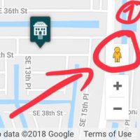


1. Locate the Street View Icon (Orange)
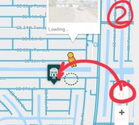
2. Drag the orange person icon to the specific location where you want to use Street View.
Streets capable of Street View have a blue line through the street.
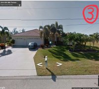
3. Google Street View Navigation
a) Use the navigation circle to turn and rotate the camera, looking in different directions. Alternatively, drag your mouse across the Street View map to pan left, right, up or down. b) Click further down the road to "walk" down the street, arriving where you clicked. For example, click two houses down the road to advance to that location. Click anywhere with a magnifying glass icon to enlarge the image. c) Click the "Full Screen" icon to expand the Street View map to cover your entire monitor. Press the "Esc" key to exit full screen mode. Press the "X" in the upper-right corner of the map to exit Street View and return to the aerial map. Source: Description of Google


